OMAHA, Neb. (AP) — A major ice storm created treacherous driving conditions across Iowa and eastern Nebraska this weekend and prompted temporary closures of Interstate 80 after numerous cars and trucks slid off the road.
Many events were canceled across the region when , and businesses announced plans to open late Saturday as officials urged people to stay home if possible. Temperatures rose high enough in the afternoon to melt the ice in most places, however.
“Luckily some warmer air is moving in behind this to make it temporary,” said Dave Cousins, a meteorologist with the National Weather Service's office in Davenport, Iowa.
At least one person died in a crash caused by the icy roads in eastern Nebraska. The Washington County Sheriff's office said a 57-year-old woman died after she lost control of her pickup on Highway 30 near Arlington and hit an oncoming truck. The other driver sustained minor injuries.
Elsewhere a storm and wind gusts of up to 60 mph (96 kph) prompted the first tornado warning in San Francisco and caused some damage. Parts of neighboring San Mateo County were also included in the warning, which went out at 5:51 a.m. to about 1 million people and was lifted about 20 minutes later.
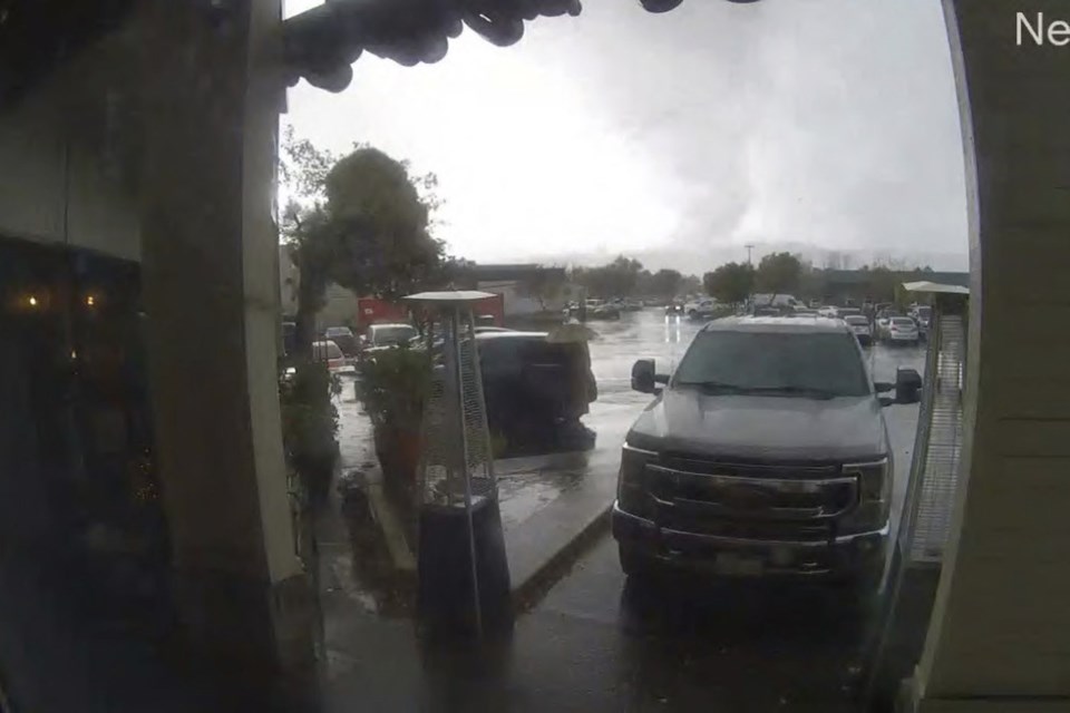
Later Saturday a tornado touched down near a shopping mall in Scotts Valley, about 70 miles (110 kilometers) south of San Francisco, overturning cars and toppling trees and utility poles, the National Weather Service said.
“Based on video, photos, firsthand accounts, and radar signatures a tornado occurred (at) 1:40 PM,” the service said, adding that a team will investigate and provide a ranking.
Images uploaded to social media showed at least three vehicles on their hood or side, with their windshields smashed and trees and power lines on the ground.
Several people were injured and taken to hospitals, the Scotts Valley Police Department said.
“The tornado has caused extensive damage in several areas, including overturning several vehicles in and around the shopping district on Mt. Hermon Drive,” the department said in a statement. It asked people to avoid the area.
One of those injured was a battalion chief with the California Department of Forestry and Fire Protection, KSBW-TV reported.
In San Francisco, some trees toppled onto cars and streets and damaged roofs. The city has not seen a tornado since 2005, according to the Weather Service. The damage was being assessed to determine if the city was indeed hit by a tornado.
“This was the first ever warning for a possible tornado in San Francisco. I would guess there wasn’t a clear signature on radar for a warning in 2005,” said Roger Gass, a meteorologist in the Weather Service's Monterey, California. He said he was not there in 2005.
The fast-moving storm prompted warnings for residents to take shelter, but few people have basements in the area.
“The biggest thing that we tell people in the city is to put as many walls between you and the outside as possible,” Meteorologist Dalton Behringer said.
In upstate New York, people were digging out after heavy snow fell. More than 33 inches (84 centimeters) was reported near Orchard Park, where residents are used to dealing with lake-effect snow this time of year.
And in Nevada, up to 3 feet (91 centimeters) of snow was forecast for Sierra Nevada mountaintops. More than a foot (30 cm) fell at some Lake Tahoe ski resorts, and a 112-mph (181-kph) gust of wind was recorded at the Mammoth Mountain resort south of Yosemite National Park, according to the National Weather Service’s Reno office.
A winter storm warning was set to expire at 10 p.m. Saturday, but an avalanche warning remained in effect into the following night for elevations above 8,000 feet (about 2,400 meters) around Tahoe.
Interstate 80 was closed along an 80-mile (130-kilometer) stretch from Applegate, California, to the Nevada line just west of Reno, where rain was falling and a winter weather advisory was in effect through the afternoon. The California Highway Patrol reopened the road in the afternoon for passenger vehicles with chains or four-wheel drive and snow tires, though it remained closed to semitrailer trucks.
In western Washington, tens of thousands of people lost electricity Saturday, local news outlets reported, amid a system that brought rain and gusty winds.
___
Associated Press reporters Olga R. Rodriguez in San Francisco, Julie Walker in New York, Becky Bohrer in Juneau, Alaska, and Scott Sonner in Reno, Nevada, contributed.
Josh Funk, The Associated Press


